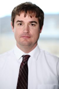
Daniel T. Lindsey, research scientist and Colorado State University alumnus working with CSU’s Cooperative Institute for Research in the Atmosphere (CIRA), received the 2016 NOAA-David Johnson Award on March 10.

Lindsey is a scientist with NOAA’s Satellite and Information Service’s (NESDIS) Center for Satellite Applications and Research. The National Space Club and Foundation presented the award to Lindsey for his work with satellite imagery.
Lindsey works with the Regional and Mesoscale Meteorology Branch at CIRA, a cooperative institute of NOAA that is housed at CSU.
“I am honored to receive the NOAA-David Johnson Award,” Lindsey said. “I love working with satellite imagery, but I could not do any of this exciting work without the help from an incredibly talented team. So, I accept this award on behalf of them.”
From data to imagery
Lindsey earned the award for his work taking data from NOAA’s satellites and turning it into imagery and products that help weather forecasters at NOAA’s National Weather Service. He has spent the past several years taking 1-minute imagery from the GOES-14 satellite and figuring out how to best use that information to understand what’s happening in the atmosphere. NOAA’s newest geostationary satellite, GOES-16, will regularly provide 1-minute imagery, once it is fully operational by November.
Lindsey said he is particularly thrilled to be a part of the team at CSU and NOAA that will take GOES-16 data and make it into products that others will use to observe and forecast weather events. GOES-16, the first of NOAA’s highly advanced geostationary weather satellites, will boost the nation’s weather observation network and NOAA’s prediction capabilities, leading to more accurate and timely forecasts, watches and warnings.
“My team here has been intricately involved in preparing for the super rapid scan imagery that GOES-16 will be capable of providing,” he said. “The data this new generation of satellites can provide are unbelievable, and will really ramp up NOAA’s abilities to issue life-saving forecasts.”
GOES-16 will scan the skies five times faster than today’s GOES spacecraft, with four-times greater spatial resolution and three-times the spectral channels. It will provide high-resolution, rapid-refresh satellite imagery as often as every 30 seconds, allowing meteorologists to take a more detailed look at a storm to quickly determine whether it is growing or decaying.
The work Lindsey and his teammates are doing includes real-time demonstrations showing the capabilities of the new generation of geostationary satellites. His work paves the way for the transition to this new state-of-the-art satellite data, and helps get scientists and forecasters ready to handle data unlike anything they have ever seen before.
Fascinated by weather
How did Lindsey wind up doing this important work?
Lindsey says he’s always been interested in and fascinated by weather, even as far back as his childhood when he was growing up in a small town in Georgia called Jasper. He ended up leaving that small town and getting his B.S. in Mathematics from the Univ. of Georgia in 1998, an M.S. in Atmospheric Science from Colorado State University in 2002, and a Ph.D. in Atmospheric Science from CSU in 2008. Lindsey joined NOAA in 2004.
NESDIS operates a fleet of environmental satellites that provide critical observations of earth and space. The data this agency provides helps promote and protect the Nation’s security, environment, economy, and quality of life. More information: https://www.nesdis.noaa.gov/
More information on GOES-16: https://www.nesdis.noaa.gov/GOES-16