At the CSU Libraries’ Geospatial Centroid, the doors are always open for a new project, no matter what it is. When a representative for Unite for Literacy approached staff at the Centroid last April to work on a project to help identify book deserts in the United States, the staff were intrigued and eager to learn more.
“What they are hoping to do is find places that are underserved and get as many books into as many homes as they can,” said Joshua Reyling, a researcher and help desk lead for the Geospatial Centroid.
A book desert is defined as a place where individual households are more likely to have fewer than 100 books in their home – a factor that researchers have determined could hinder the likelihood that a child makes it through high school.
That’s where Unite for Literacy comes in. This national organization based in Loveland is dedicated to supplying books to families who may not have many – or any – books within their household.
To help find those families, Unite for Literacy partnered with researchers at the Centroid to create a predictive model using a combination of governmental data and their own knowledge gathering.
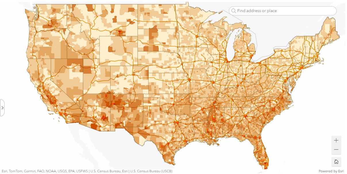
What the data showed
With relevant spatial data from a variety of sources, Centroid staff was able to create a predictive model to estimate where there is the greatest likelihood of households that may or may not reach that 100-book threshold.
“Some of the variables that we thought would be very telling were not,” Reyling said. “Things like the availability of books in a community or early childhood education centers were a much bigger factor.”
Geospatial data provides a way to visualize, overlay and help predict patterns in communities. Demographic data like economic status, employment and adult education were used in this research. These variables can reveal underlying factors contributing to larger problems.
Unite for Literacy and its partners use information from this research to pinpoint what areas are in need of more books. After this, the organization can provide books to families in these areas.
According to the predictive model, families in the Fort Collins area are generally more likely to have more than 100 books in their home, but places in the Denver metropolitan area such as Westminster, Thornton and Commerce City appear much less likely to meet this number.
On the map on the Unite for Literacy website, they highlight places that are a “Book Equity Focal Area,” where the organization intends to focus their efforts.
“The organization provides little early reader books,” Reyling said. “They’re simple things that kids can read to their parents.”
Beyond the books
By working on a diversity of projects both internal and beyond CSU, the Centroid often sees repeated patterns. Distribution and spatial patterns of race, income and education levels seem to align consistently with issues related to social and environmental justice.
“Sometimes it’s kind of disheartening,” Reyling said. “You see [these patterns] and it seems so obvious that they exist in everything.”
Without geospatial technology and researchers, these patterns are far less likely to be revealed. Organizations similar to Unite for Literacy rely on this technology to find what places need help and what factors may be contributing to the greater problem of book deserts.
How to get involved with the Geospatial Centroid
- Student internships: Students can get involved with the Centroid by becoming an intern, where they can work on projects internal and external to CSU. Internships are open to students from any major in any year.
- Consulting and training: The Centroid offers technical services in spatial analysis, cartography, interactive web applications and remote sensing.They also offer periodic training and workshops in standard GIS software applications, programming and other related topics.