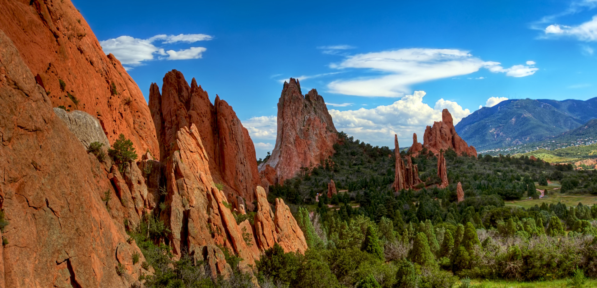
Conserved lands are woven into the fabric of Colorado, making up nearly 35 percent of the state, or roughly 30 million acres, according to the Statewide Comprehensive Outdoor Recreation Plan. Even more acreage is conserved through conservation easements on private lands.
These lands are managed by a plethora of public agencies at every level of government as well as non-governmental organizations like the The Nature Conservancy, local land trusts and even private land owners. Can you imagine bringing all of them together to build a map of protected areas throughout the state?
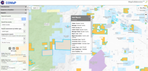
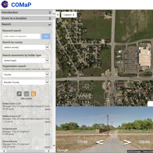
The task is so daunting that there is, in fact, only one comprehensive map of Colorado’s protected lands in the state, and in its 10th version, it’s making a tremendous breakthrough. The Colorado Natural Heritage Program, with help from Colorado State University’s Geospatial Centroid, recently launched a new COMaP system, for the first time allowing subscribers to use the map in a web-based interface.
COMaP, the Colorado Ownership, Management and Protection Dataset, started as a Geographic Information System research project in CSU’s Department of Fish, Wildlife, and Conservation Biology in 2004. Since then, it has evolved into an important tool for those around the state with an interest in privately and publicly protected lands.
“This really is the only comprehensive source of protected areas information in the state,” explained Dave Anderson, CNHP director and chief scientist. “Nothing else has this level of detail or includes such a broad coverage of conservation easements.”
In previous versions, users requested data sets to import into GIS software, and then checked in periodically to receive updates. Not only did that mean the only people who could use those data had to be GIS experts, but keeping it all up-to-date was a nightmare.
COMaP 10 changes everything. The web-based system is accessible to subscribers through web browsers, and if you can use Google Maps, you can use COMaP. The new version also allows users to submit edits and suggestions directly to CNHP staff, allowing them to vet and apply updates quickly and efficiently.
These changes will make the map, already a popular tool for the conservation community around the state, more up-to-date. It also means it will be accessible to a host of new users in the water, energy and real estate sectors.
The value of COMaP is immense for the small utility and oil and gas firms the state works with, explained Kathleen Staks, assistant director at the Colorado Department of Natural Resources. “For a lot of smaller organizations that don’t have GIS technicians on staff this will be a huge benefit, and I think they’ll use it a lot,” she said.
Staks added that the tool is helpful to her and colleagues in the Department of Natural Resources. “Any time we get questions about the amount of protected land in the state, protected habitats and ecosystems, considerations about species of concern, we need to be able to tell a clear story,” she said. “COMaP makes that easy to do, especially for those of us without a background in GIS.”
This tool brings more people to the table in conversations about land, said Amanda Barker, executive director of the Colorado Coalition of Land Trusts. “Land trusts and local governments have commitments to planning at local, county levels, to identify prime opportunities for conservation,” she said. “Mapping tools allow interested parties to think critically about protected lands and make more informed decisions as a community.”
Barker went on to cite the importance of the data being maintained by an impartial third party such as CSU. “It’s pretty savvy that the data are housed at a public university,” she said. “A lot of the discussions around land conservation can be sensitive, so an unbiased source of data is a real asset.”
COMaP will also serve as the base data layer for the Colorado the Beautiful Initiative launched last year. The effort, set forth by Gov. John Hickenlooper, sets out to, among other things, provide a comprehensive map of recreation areas and trails in the state.
If you’re interested in a subscription, visit the COMaP website for more details. Annual fees include rates for nonprofit organizations ($175), government agencies ($300), small businesses ($300) and corporations ($500). There is also an academic rate that gives academic units the opportunity to use COMaP for research or in the classroom as a teaching tool.
Funding for the new system and previous versions stems in part from Great Outdoors Colorado.
The Colorado Natural Heritage Program is Colorado’s only comprehensive source of information on the status and location of the state’s most threatened and endangered species. A member of the NatureServe Network of Heritage Programs, CNHP is a part of the Fish, Wildlife, and Conservation Department in the Warner College of Natural Resources at Colorado State University.