Cold front, upslope winds
On July 27, an unusually strong cold front also moved into the region from the north, while moisture continued to stream into Colorado from the south, above the cold front. As the cold front moved over the state, easterly upslope winds began to push very humid surface air into eastern Colorado. As the moist surface air funneled into the Front Range foothills and mountains, it was forced to rise, cool, and saturate. This combination of saturated air with a source of lift allowed slow-moving thunderstorms to develop.
Taken together, all of these conditions set the stage for the heavy, localized rains that followed. Torrents of rain in the lower foothills saturated the soils, caused initial flooding outside of town, and led to the major catastrophe that hit Fort Collins and CSU two decades ago.
Monday morning, July 28, dawned dark, cloudy and very humid, Doesken said. What followed were crescendos of warm rain that came in waves and didn’t let up, unlike typical cloudbursts in the Rockies. In this case, as the storms shifted across town southwest to northeast, new cells would reform right over southwest Fort Collins, dumping more rain. According to Doesken, the conditions were similar to those of the devastating July 31, 1976, flash flood in the Big Thompson Canyon.[3]
Aftermath, documentation
As Assistant State Climatologist, Doesken’s job at the time was to document the rainfall that had taken place and the devastation that ensued. He asked schools, companies, and citizens to report rainfall totals they’d experienced. These efforts led to the creation of the Community Collaborative Rain, Hail and Snow Network (CoCoRaHS)[4], now an international citizen science effort of 20,000 volunteers reporting precipitation from their backyards and compiled at CSU.
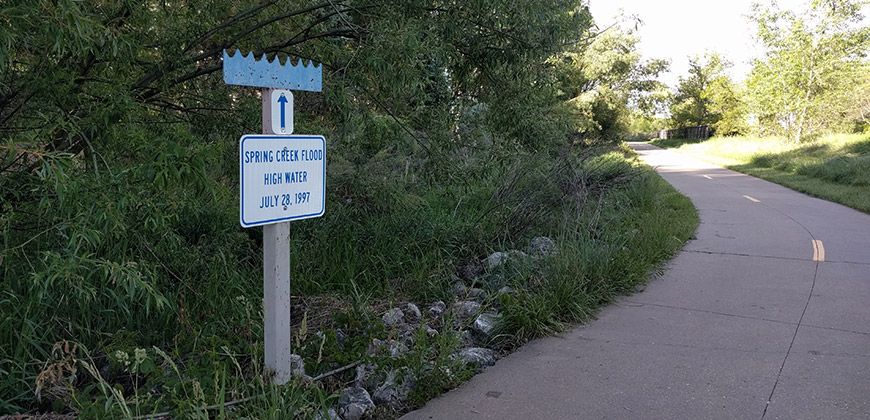
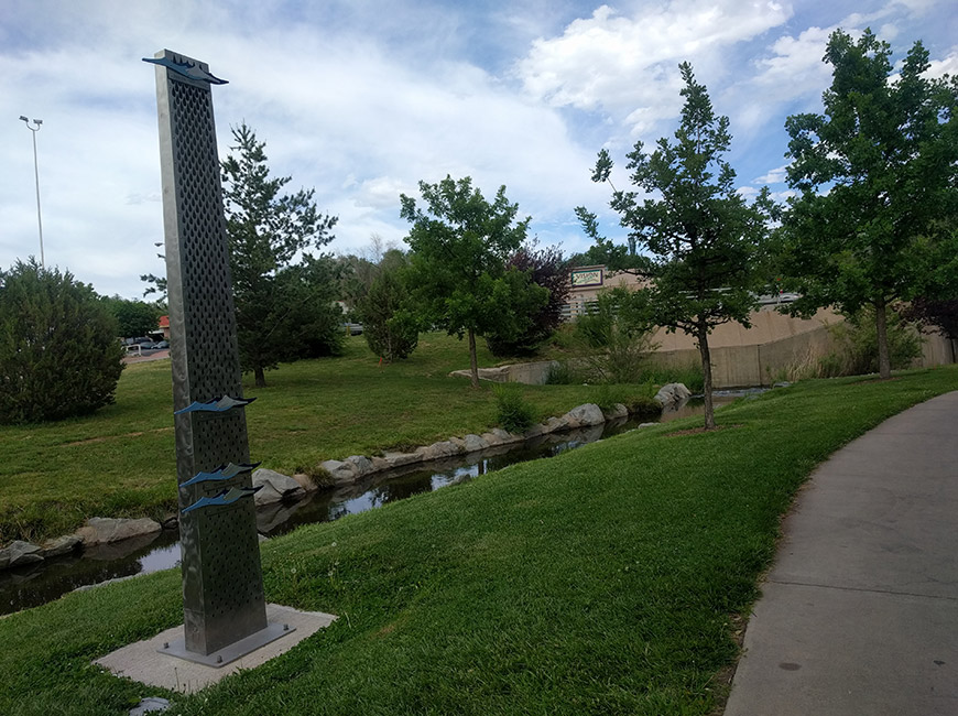
All told, more than 300 people reported rainfall totals following the July 28, 1997, flood. Together with radar and satellite data, Doesken and colleagues stitched together a detailed map with localized totals in the city. The highest topped out at 14.5 inches near Quail Hollow. The state of Colorado typically receives 15 inches of rain in a year.
1 in 500
The flooding that occurred near College Avenue and Spring Creek was assessed by hydrologists to be caused by a 500-year storm. Statistically, that means such an event has a 1 in 500 probability of occurring in any given year.
A 500-year storm is a term that people often misunderstand, according to climatologists.
“Having an event like this doesn’t reset the clock. The next day, you have the same chance,” explained Becky Bolinger, a climatologist and drought specialist with the Colorado Climate Center. “It’s incredibly rare, but it doesn’t mean it won’t happen again in our lifetime.”
As if to prove her point, in September 2013, another major rain event soaked the Front Range, with floodwaters damaging areas of Boulder and Lyons and closing the CSU campus.
By that time, Fort Collins was better equipped to handle heavy flooding, due to collaborative efforts between CSU and the city, said climatologist Peter Goble of the Colorado Climate Center. There have also been improvements in radar data, forecasting, and citizen rain reporting from CoCoRaHS.
“We were not as well warned in 1997,” Goble said. “We didn’t have the same real-time observations and richness of data that we do today.”
Read more about the 1997 flood. [5]