“I think this imagery is a really great tool to educate people about what’s going on,” Smith said. “I remember the first time I saw imagery like this, and it gave me an entirely different and more accurate perspective of our weather and how it is formed.”
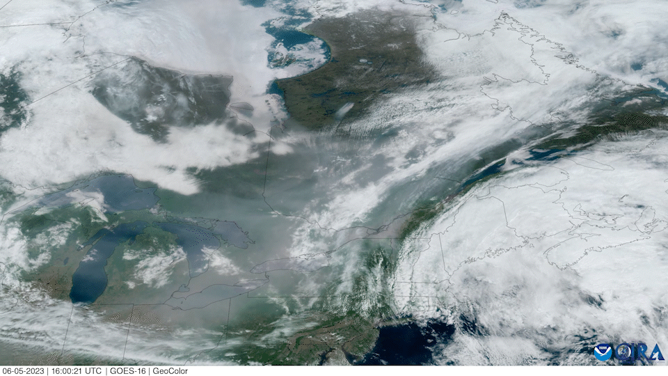
CIRA has been tracking the smoke since May 5, when thick smoke from the wildfires in Quebec began to move south and impact air quality in the western U.S. In early June, the fires persisted – and the smoke began to impact the eastern half of the U.S.
(CSU/CIRA & NOAA)
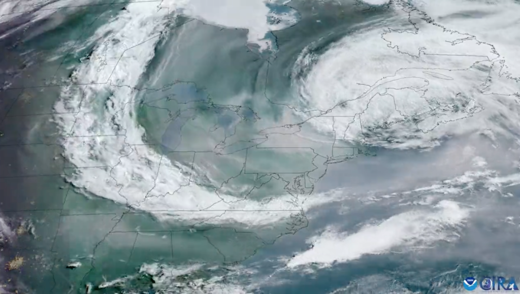
The aerial footage showed how a coastal low steered that smoke over the Northeast and mid-Atlantic.
(CSU/CIRA & NOAA)
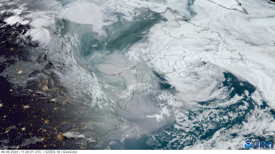
The aerial images also capture the dozens of fires in Quebec that are responsible for the haze.
(CSU/CIRA & NOAA)
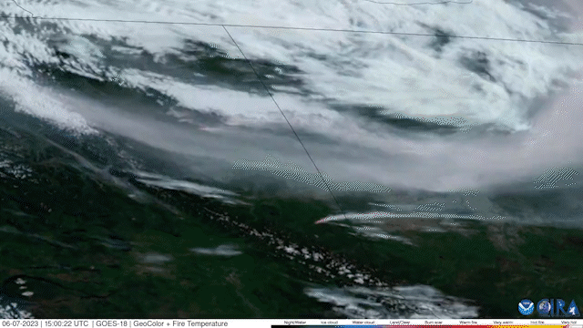
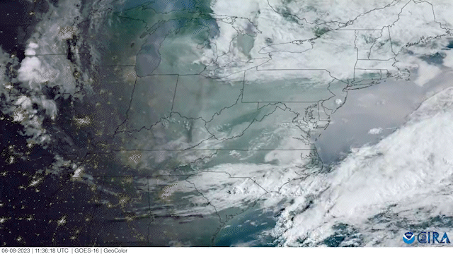
As of June 8, some of the haze has dissipated, but CIRA’s images show that it’s continued to linger over much of the eastern half of the U.S.
(CSU/CIRA & NOAA)
Every day, the CIRA team shares images of weather events happening around the world, from hurricanes to intense lightning storms.
All of these images are in the public domain and available for media use. The latest images of the air quality impacts of the wildfires in Canada are available at: https://col.st/NgSDu. An archive of past images and events is available at: https://col.st/xykjq
For general requests for imagery or for video of a specific region, visit: https://col.st/IQaff