How do you get to the Colorado State University campus? Whether you are a pedestrian, bicyclist, or rely on regularly scheduled city buses, you know transportation to and from campus has transformed since 2013. That’s thanks to smart leadership, skilled students, and location-based data.
A longstanding partnership between CSU’s Parking and Transportation Services and the Libraries’ Geospatial Centroid, recently featured in the publication ARCUser, provides meaningful mapping products for transportation decision making, while developing the geospatial technical skills of student interns.
For the past seven years, Aaron Fodge, director of alternative transportation, and Sophia Linn, assistant director at the Geospatial Centroid, have worked together to create an ever-evolving series of tasks that provide PTS with data-driven analysis and visualizations.
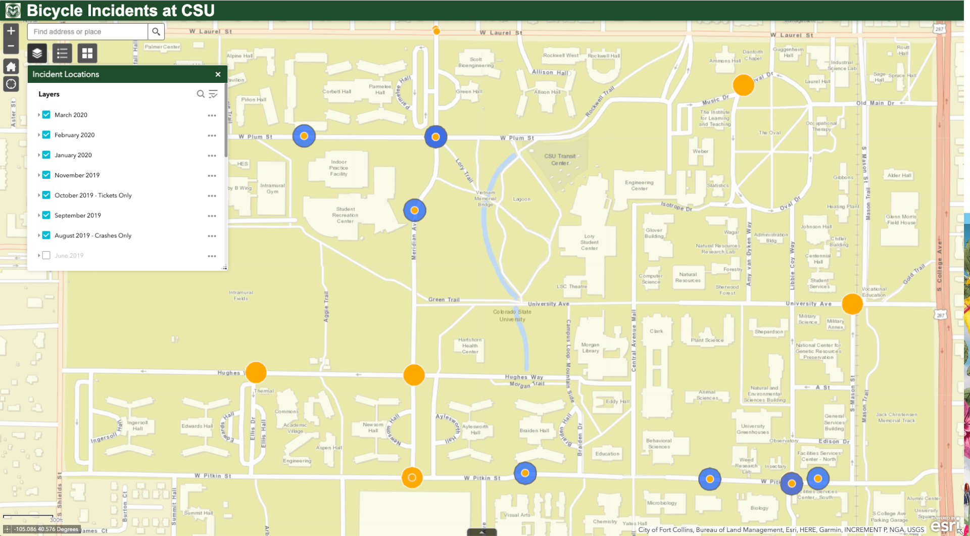
From mapping incidents of bicycle crashes and tickets to determining the boarding locations of every CSU-affiliated Transfort user, location-based data paints a clear picture of transportation patterns and problems on and around campus. Plotting the anonymous address locations of CSU commuters on a map, and overlaying bus and bicycle routes, immediately show areas of gaps in service.
The result is interactive maps, such as Bicycle Incidents at CSU and CSU Transfort Boardings, that allow leaders to design informed solutions so transportation is safer, more convenient and more equitable.

Ross interim director of Geospatial Centroid
As CSU researchers increasingly embrace the power and insights of location-based data, Geospatial Centroid has a new interim director to help shape the campus research landscape. Matthew Ross, assistant professor in the Department of Ecosystem Science and Sustainability, will begin his appointment as interim director on Jan. 1, 2021.