New drone application improves tracking for songbird research


A Lazuli Bunting perches on a branch. Attached to the bird is a transmitter, which tracks the bird’s movements
A Lazuli Bunting perches on a branch. Attached to the bird is a transmitter, which tracks the bird’s movements. (Photo by Jon Tenberge)

CSU drone experts have helped develop a way to track songbirds during breeding season in the central and western regions of the Great Basin, an application that shows promise for wildlife biology in general.

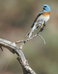
The university’s Drone Center partnered with researchers at Oregon State University to deploy a new and unobtrusive way to study how birds – specifically Lazuli Buntings and Green-tailed Towhee – respond to environmental change. They found some species regularly move upslope in mountains during their breeding season, whereas one species moves downslope.

While recent studies about changes in the geographic distributions of breeding birds focused on changes over decades or longer, this research fills a gap by looking at seasonal shifts. The findings build upon research in the Great Basin over the past 20 years.

“We’re trying to do something that we haven’t been able to do before,” said Erica Fleishman of Oregon State University, a principal for the study and director of the Oregon Climate Change Research Institute. “To understand why songbirds may be moving upslope or downslope within their breeding season, it’s important to understand whether the same individuals are moving or whether some individuals are moving out and others are moving in. We really need to know what individual birds are doing.”

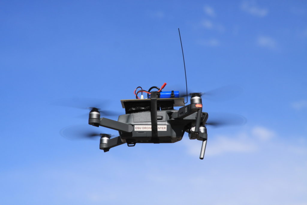
Fleishman collaborated with CSU Master Instructor Luke George, who has a long history of tagging and following birds. They turned to Christopher Robertson, director of the Drone Center, who connected them to Cellular Tracking Technologies. The company specializes in wireless tracking of animals. The collaborators developed a transmitter to track individual birds in real time without harming them.

A drone prototype developed by the Colorado State University Drone Center flies in the air

The drone prototype for Fleishman and George’s research on movements of songbirds in the Great Basin. (Photo courtesy of Christopher Robertson)


This aerial image illustrates the signal strength of a radio tag as received by the drone in flight. Green dots indicate a stronger signal, whereas orange dots indicate a weaker signal. The black dot indicates the actual location of the tagged bird.
This aerial image illustrates the signal strength of a radio tag as received by the drone in flight. Green dots indicate a stronger signal, whereas orange dots indicate a weaker signal. The black dot indicates the actual location of the tagged bird. (Photo by Ned Horning)

The technology overcomes limitations of other methods, such as GPS tracking, which don’t work well for small birds. It shows promise for studying other wildlife in remote areas too.

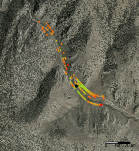
“We really micronized the system, and it works pretty well,” Robertson said. “We can fly the drone in a specific pattern over a specific area, get these signals, and then geolocate the bird with one receiver off the signal strength.”

Drone applications are rapidly proliferating as the technology is used for search and rescue, recreation, engineering and construction, science research, agriculture, and filmmaking. The Drone Center works with CSU experts to support third parties seeking innovative and practical ways to use the technology. 

“The whole goal of the Drone Center in the research arena at CSU is offering a turnkey flight solution, logistic solution and consulting solution when it comes to drones or unmanned aerial systems,” Robertson said. “Working with drones can be very technologically advanced and very challenging, and developing the skill set can take months to years to even get to be effective. The Drone Center’s mission is really to offer the researchers a chance for them to come to us and figure out if their idea is feasible.”

Fleishman agrees, saying that without the development of the drone platform, the team would not have a good option for tracking individual birds.

“We would have a lot of hypotheses about why birds are moving during their breeding season, but we wouldn’t be able to investigate them,” Fleishman said. “This collaboration has given us a means to address a question that we wouldn’t be able to answer otherwise.”


Colorado Drone Airshow

The CSU Drone Center hosts the Colorado Drone Airshow Oct. 6 and 7, 2023, at Christman Airfield in Fort Collins.

When: Oct. 6, 2023, for industry professionals and Oct. 7, 2023, for the public

Where: Christman Airfield at 3985 Laporte Ave., Fort Collins, Colorado

Register: The public is invited to attend to watch the demonstrations. Please register to attend here.