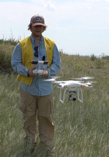
Modern technology met ancient history recently when a group of Archaeology Field School students at CSU helped map and photograph the famed Lindenmeier archaeological site using drones.
The Lindenmeier site, located about 25 miles north of Fort Collins, is a National Historic Landmark and one of the largest Folsom sites in the Western hemisphere. Its discovery in 1924 and subsequent excavation from 1934-40 shocked the world, proving that humans had been in North America more than 11,000 years ago – long before scientists previously believed people had arrived.
Rich history
The Lindenmeier site was excavated by the Smithsonian Institution and yielded hundreds of arrowheads, needles, beads and bison bones linked to Ice Age Native Americans. The three-acre site is now part of the 22,000-acre, Fort Collins-owned Soapstone Prairie, which is also home to the Laramie Foothills Bison Conservation Herd, which CSU scientists played a key role in establishing.
CSU students, along with associate professor of anthropology Jason LaBelle, are mapping the site with drones to help identify areas where artifacts have been exposed by erosion caused by wind and rain to help strategically determine future excavation areas. The site has not been actively excavated in more than 70 years but artifacts are still present.
Support field school scholarship
The project is part of the CSU Department of Anthropology’s annual Archaeology Field School. Information about supporting a student in the Archaeology Field School via Anthropology Field School Scholarships is available online.