
A Colorado State University-run precipitation monitoring network is now getting data from the country’s most famous address – 1600 Pennsylvania Avenue.
The White House installed an official Community Collaborative Rain, Hail and Snow Network – or CoCoRaHS – rain gauge in the First Lady’s Kitchen Garden this week and the National Park Service personnel who manage the grounds began submitting observations over the weekend in anticipation of the White House Science Fair. 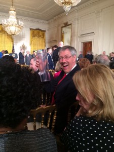
Nolan Doesken, the director of CoCoRaHS, said the White House gauge, which was installed in collaboration with NPS and the National Atmospheric and Oceanographic Administration, is already improving the CSU-based network’s ability to track precipitation in the area.
“Washington DC is a very densely developed area and it’s been almost impossible to find a good place for a rain gauge and willing volunteers to read it,” said Doesken, who helped train the staff to measure, record and submit precipitation data. “It turns out that the South Lawn of the White House is a perfect location, and the National Park Service White House horticulture staff is ideally suited to staff this gauge. The daily reports are already coming in.”
Citizen science
More than 20,000 active volunteers contribute data to the CoCoRaHS Network, making it the largest source of daily precipitation data in the country. Observers report measurements from coastal lowlands to the high peaks of Rocky Mountain National Park.
The White House is the latest – and most famous – volunteer in the CoCoRaHS citizen science project.
“We’re demonstrating that citizen science can happen anywhere, even at the White House,” said Jenn Gustetic, assistant director for open innovation at the White House Office of Science and Techno
logy Policy. “Citizen science empowers people and communities to directly participate in the scientific process outside of traditional classroom settings, and to help expand the frontiers of knowledge in ways that make a difference.”
CoCoRaHS data are used by a wide variety of groups, including the National Weather Service, private sector and university meteorologists, hydrologists, emergency managers, city utilities, insurance adjusters, the U.S. Department of Agriculture, engineers, ranchers and farmers and others.
How CoCoRaHS started
Doesken and his colleagues launched CoCoRaHS in 1998, a year after Fort Collins and CSU experienced widespread flooding and subsequent damage.
The amount of flooding and its toll caught many by surprise.
“We decided then that we needed to start documenting how much rain we were getting and make it more available to weather forecasters so we weren’t caught off guard again,” Doesken said. “We wanted to be able to track and record it better so we could alert people earlier.”
The CSU team started training local volunteers to accurately record and report precipitation data. The network eventually spread across Colorado.
The program took off in 2003 and then again in 2006 when the National Science Foundation and NOAA awarded CoCoRaHS grants to expand. The CSU network has volunteers in all 50 states, Puerto Rico, U.S. Virgin Islands, Canada’s 10 provinces – and now, the White House.
Doesken hopes the White House installation inspires others to volunteer and record data – especially in urban areas.
“The White House’s commitment to encouraging public participation in science is fantastic,” Doesken said. “The fact of the matter is that precipitation in urban areas has a great deal of impact — flood potential, storm water management, water quality, transportation, snow removal and we need to know more about it.”