The 2015 hurricane season had below-average activity, although observed levels of activity were slightly more than predicted by the Colorado State University hurricane forecasting team.

“The 2015 hurricane season had activity at levels slightly more than predicted. The season had an approximately average number of named storms, but most of the hurricanes that formed this year were very short-lived,” said Phil Klotzbach, lead author of the forecast. Seasonal Accumulated Cyclone Energy (or ACE) was approximately 65 percent of the 1981-2010 median.
The report summarizes all tropical cyclone activity in the Atlantic basin during the 2015 hurricane season and compares the team’s seasonal and two-week forecasts to what actually occurred.
El Nino suppressed storm activity
Several factors likely combined to make the season quiet. The primary reason why tropical cyclone activity was limited was the strong presence of El Nino. El Nino – warmer than normal water in the central and eastern tropical Pacific – suppresses storm activity in the Atlantic due to increases in vertical wind shear (the change in wind direction with height in the atmosphere).
Vertical wind shear in the Caribbean was the strongest on record since at least 1979 for June-October. The tropical Atlantic, which began quite cold this year, warmed up significantly over the course of the season, likely aiding in the development of several weak tropical cyclones in the eastern part of the Atlantic basin.
The Colorado State team of Klotzbach and William Gray made their long-range seasonal forecast, which called for a below-average hurricane season, on April 9 and June 1. Two additional updates during the hurricane season were issued on July 1 and August 4. Each of these updates continued the call for a quiet season.
In their first forecast issued April 9, the team called for seven named storms, three hurricanes and one major hurricane. The June 1 and July 1 forecasts called for eight named storms, three hurricanes and one major hurricane. The August 4 update called for eight named storms, two hurricanes and one major hurricane. Observed activity was 11 named storms, four hurricanes and two major hurricanes.
Below-average ACE was correctly predicted by all of CSU’s seasonal forecasts; however, the observed level (62 ACE) was slightly higher than forecast (40 predicted in April, June and July and 35 predicted in August). For comparison, 1981-2010 median ACE is 92.
Sixty years of historical data
The team bases its annual forecasts on 60 years of historical data and includes factors such as Atlantic sea surface temperatures and sea level pressures, levels of vertical wind shear (the change in wind direction and speed with height), El Nino (an anomalous warming of waters in the central and eastern tropical Pacific) and other factors. While these forecast factors generally work well and explain approximately 50-60 percent of the year-to-year hurricane variability in these 60 years of historical data, there still remains 40-50 percent of this variability which is not explained.
Hurricane statistics for 2015 contained in the report include:
- Four hurricanes formed in 2015, which brings the combined 2013-2015 total to 12 hurricanes. This is the lowest three-year total since 1992-1994 (11 hurricanes).
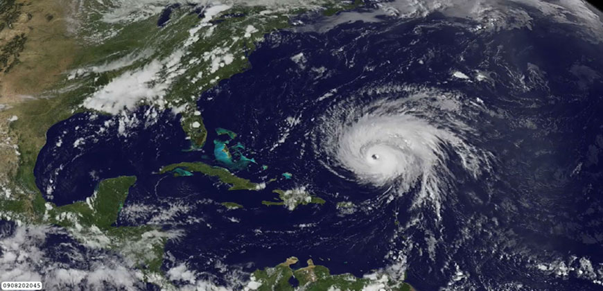
- Hurricane Joaquin was the first Category 4-5 hurricane to impact the Bahamas during October since 1866.
- Florida has gone without a hurricane impact since 2005 (10 years). This is the longest period on record, shattering the previous record of five years from 1980-1984.
- No major hurricanes made U.S. landfall in 2015. The last major hurricane to make U.S. landfall was Wilma (2005), so the U.S> has now gone 10 years without a major hurricane landfall. Since 1878, the U.S. has never had a 10-year period without a major hurricane landfall.
Few major U.S. hurricanes in recent years
Although the Atlantic has seen a large increase in major hurricanes during the recent period of 1995-2015 (average 3.4 per year) in comparison with the prior 25-year period of 1970-1994 (average 1.5 per year), the U.S. has been fortunate that few major hurricanes have made U.S. landfall (except for the two very damaging years of 2004-2005). The Atlantic basin has had 27 major hurricanes since Wilma, with no major hurricane landfalls. The 20th-century average is that approximately 30 percent of all major hurricanes forming in the Atlantic make U.S. landfall.
Klotzbach and Gray attribute the upturn in major hurricane activity since 1995 as well as the earlier increase in major hurricane activity from the late 1940s through the mid-1960s to natural multi-decadal variability in the strength of the Atlantic Multidecadal Oscillation (AMO) or Atlantic Thermohaline Circulation (THC).
A concomitant increase in a number of favorable hurricane-enhancing parameters occur in the tropical Atlantic during the positive phase of this oscillation. These same parameters tend to suppress hurricanes during the negative phase of this oscillation. Three quiet hurricane seasons in a row have raised the question that the active AMO may be ending.
Klotzbach and Gray think this may be the case, but it is too early to say for sure at this point.
The Tropical Meteorology Project has been issuing forecasts for the past 32 years. A brief qualitative outlook for the 2016 hurricane season will be issued on Thursday, Dec. 10 with a first full forecast issued in early April 2016.
Read the full verification report and a chart showing the predictions vs. observed storms. The report includes an extensive discussion of the climate features that caused the 2015 Atlantic basin hurricane season to have below-average activity.