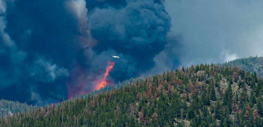
Wildfires are as much a part of western landscapes as the forests that depend on them for survival. But as development in the Wildland-Urban Interface grows, the potential for wildfire property damage dramatically increases. In fact, Colorado’s most expensive wildfires in terms of insured losses have all occurred since 2010, and included significant damage in WUI communities.
New landscape for addressing wildfires
WUI development means a new landscape for addressing wildfires. “Today’s forests are a coupled environmental and social system,” says Mike Caggiano, research associate at Colorado State University’s Center for Managing WUI Fire Risk. “Many forest ecosystems in Colorado and the west now include structures and other social assets, and have to be managed accordingly.”
The WUI Center and Caggiano are developing a ‘values at risk’ spatial database to provide information for land managers to improve wildfire risk reduction strategies and responses to wildfires.
Wildfire risks
The database combines individual building locations in the WUI for ten Colorado counties with physical and social data, and post wildfire home loss assessments. Together, these data show where wildfire risks overlap with infrastructure in the forests, at a higher resolution and level of detail than other maps available today.
Other maps rely on less detailed information such as U.S. Census data. “Census data shows the general population, but doesn’t have building locations so it isn’t as helpful from an operational perspective,” said Caggiano.
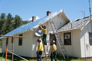
Wildfire incident management teams and fire districts that triage areas and deploy resources during a fire need to know where individual structures are located. Determining access routes, the physical characteristics around buildings, and the proximity to vegetation or other buildings provides valuable information for emergency response.
Making resource decisions
These factors, construction material, and the amount and quality of defensible space are often used to estimate a homes chance for survival during a fire. But that’s hardly a straightforward calculation, especially when it is difficult to know the exact fire exposure a house may encounter. “The database will provide information to help managers make appropriate decisions about deploying resources,” Caggiano said.
Emergency response operations are only part of the database’s utility. It will also help ongoing research on land use patterns and building codes in relation to wildfire risk, and in identifying locations where reducing the amount of fire prone vegetation could decrease the fire danger to homes and communities.
Pilot projects
A number of pilot projects will utilize the database, including one with the Colorado State Forest Service, Denver Water, the Natural Resource Conservation Service and The Nature Conservancy to reduce the wildfire risks to water supplies and communities in the Upper South Platte River Watershed.
WUI Center
The WUI Center, in the Warner College of Natural Resources, plans to expand the database to cover the entire state, and will work with agencies and organizations to make it available for land managers and fire personnel.